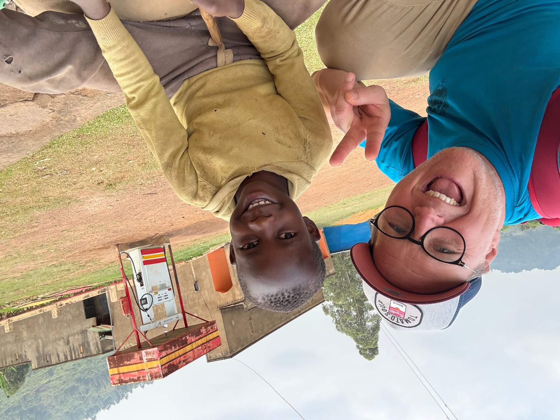
In January 2026, near the edge of a road in Buhoma in southwestern Uganda, I came across a boy sitting on a mound of broken stone. He was around ten years old, working methodically under the midday sun — picking up stones, positioning them, bringing a hammer down. The fragments he produced would be sold to serve as aggregate for building foundations. He was not despondent about it. When he noticed us watching from the vehicle, he looked up and grinned, curious and entirely at ease with being seen. There was nothing performative about his situation and nothing to romanticise in it either: this was a child doing difficult physical work because his family needed the income.
That image from January 2026 — captured at GPS coordinates 0.9649° N, 29.6144° E and also photographed during a similar encounter in October 2024 — carries a specific weight when you then read Uganda's National Status of the Environment Report 2024 (NSOER 2024). The report documents four critical environmental challenges facing Uganda: air pollution, water contamination, land degradation and biodiversity loss. These are not abstract categories. Land degradation affects the soils that smallholder families depend on. Water contamination affects the rivers and wetlands that regulate the quality of Uganda's lakes. Biodiversity loss reduces the natural systems — forests, wetlands, savannas — that buffer communities against drought, flood and food insecurity. A boy breaking stones in Buhoma to supplement his family's income is, among other things, the end product of a landscape under pressure.
Uganda's wetlands stand at the centre of these intersecting pressures. They cover approximately 13% of Uganda's total land area (NSOER 2024, Part 7) — a substantial fraction for any country, and a particularly significant one given that Uganda sits at the headwaters of the Nile and contains several of Africa's most important freshwater lakes. What happens to those wetlands shapes what happens to Lake Victoria, to the fish stocks that sustain millions of people, and to the water quality of a basin shared across three countries.
What Uganda's Wetlands Actually Are
The word "wetland" is broad enough to encompass a wide range of ecosystems, and Uganda's version of it covers an unusually diverse range. The most visible are the papyrus swamps — dense stands of tall sedge grass that fringe the shores of Lake Victoria, Lake Kyoga and much of the Nile system. Papyrus swamps are perhaps the defining visual feature of Uganda's lowland landscape: the thick green stalks rising several metres above water level, forming walls of vegetation that are almost impossible to penetrate on foot. Beneath them, the slow-moving water filters nutrients and sediment from agricultural runoff before it reaches the open lake.
Beyond papyrus, Uganda's wetlands include seasonally flooded grasslands, riverine forest strips, lake margin swamps, and the complex mosaic ecosystems around Uganda's crater lakes in the western Rift Valley. Each type performs a distinct set of ecological functions. Riverine forests stabilise river banks and prevent the erosion that increases sediment loads in lakes. Seasonal floodplains recharge groundwater and provide temporary grazing for livestock during dry seasons. Lake margin swamps provide nursery habitat for juvenile fish — including the commercially important tilapia and mukene species in Lake Victoria — in sheltered, vegetated shallows where predation pressure is lower than in open water.
Wetlands also perform functions that have no direct market value but underpin a significant portion of Uganda's agricultural economy. They regulate the timing of water release into rivers, moderating both drought and flood impacts downstream. A wetland that absorbs heavy rainfall and releases it slowly over weeks prevents the kind of flash flooding that destroys crops and erodes topsoil. In a country where NSOER 2024 identifies declining soil fertility as a critical agricultural challenge, every mechanism that reduces erosion and maintains organic matter in the soil has real economic significance.
The Scale of Loss — 5,000 Hectares a Year
Uganda is estimated to be losing approximately 5,000 hectares of wetland per year (NSOER 2024, Part 7). To understand what that number means in practice, it helps to think about it in terms of what replaces the wetland rather than what disappears. In most cases, the answer is farmland — particularly rice paddies and sugarcane fields, which require drainage to be cultivated. In and around Kampala and secondary cities, it is urban expansion: buildings, roads and informal settlements encroaching on low-lying land that was previously too wet for permanent development.
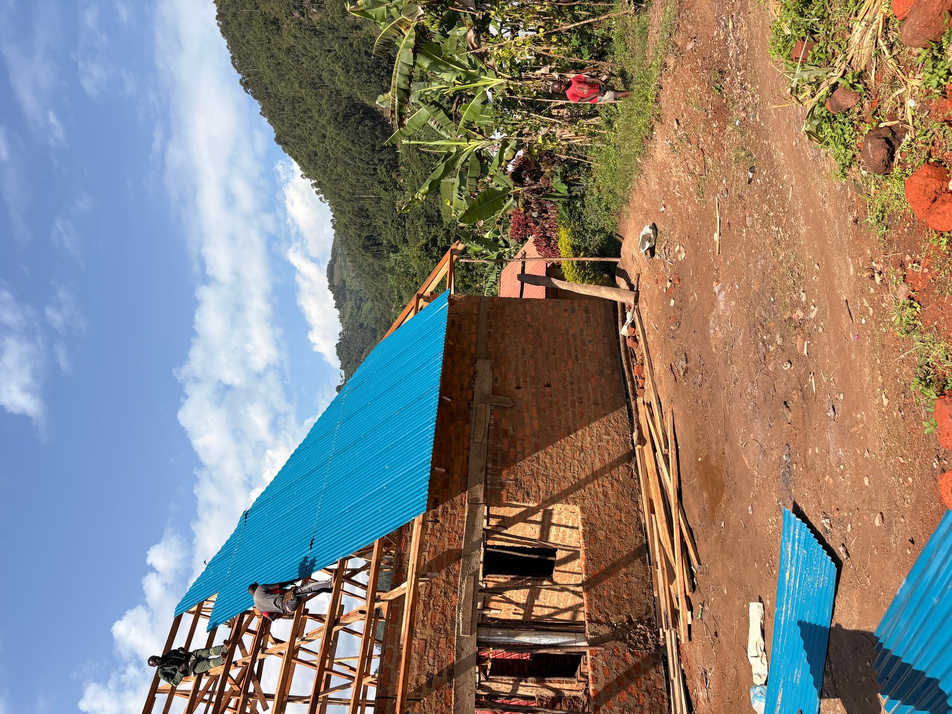
Brick-making is a less obvious but significant contributor to wetland loss in Uganda. Wet clay soils — found throughout Uganda's wetland areas — are the primary raw material for the fired-clay bricks that dominate construction across the country. The HopeKitchen building site in Buhoma, photographed in May 2026 as its roof structure was being completed, was built with exactly these bricks — a reminder that every building in Uganda's construction boom represents clay extracted from somewhere, and that extraction increasingly targets wetland margins where the right clay type is accessible.
The connection to Lake Victoria is direct. The wetlands that ring the Ugandan shoreline — and extend along the rivers that drain into the lake — are the primary filter system between agricultural land and open water. When they are drained or built over, the runoff that previously passed through them at a walking pace and deposited its nutrient and sediment load in the vegetation now flows directly into the lake at full speed, carrying everything with it. The elevated phosphorus and nitrogen levels that fuel water hyacinth growth in Lake Victoria are, in significant part, a consequence of reduced wetland buffering capacity upstream of the lake.
The pressures do not operate in isolation. NSOER 2024 identifies invasive species as a compounding factor on Uganda's biodiversity broadly — and in wetland contexts specifically, water hyacinth is both a symptom of degraded wetland function (because it thrives on the nutrients that healthy wetlands would intercept) and a cause of further degradation (because the dense mats it forms kill off the submerged and emergent vegetation that characterises healthy wetland communities). The cycle is self-reinforcing: less wetland means more nutrients entering the lake, which means more water hyacinth, which means further damage to littoral wetland vegetation.
Water Quality in Uganda's Rivers and Lakes
The question of water quality in Uganda's lakes and rivers is inseparable from the question of what is happening to the land around them. NSOER 2024 identifies water contamination as one of four primary environmental challenges in Uganda (Part 2), with sources ranging from agricultural runoff carrying pesticides and excess nutrients to industrial effluents and inadequately treated urban sewage. The report covers five main components of environmental health — air quality, water resources, land, biodiversity, and urban development — and their interaction across these components is precisely what makes the situation at Lake Victoria so complex.
Agricultural chemicals present a particular challenge. Uganda's farming sector has expanded significantly in recent decades, with intensification of production in areas around Lake Victoria, particularly for horticultural exports. The pesticides and fertilisers applied in these areas enter waterways through surface runoff and groundwater movement. Where wetlands are intact, they intercept and partially metabolise these inputs. Where wetlands have been drained, the inputs reach rivers and the lake more or less directly.
Zoonotic diseases — illnesses that can transfer between animals and humans — are also flagged in NSOER 2024 as a pressure on biodiversity, and the connection to water quality is real. Uganda's wetlands provide habitat for a range of wildlife including waterbirds, reptiles and fish. When water quality deteriorates, species assemblages shift. Tolerant generalists replace sensitive specialists. The diversity of the wetland community collapses toward a small number of stress-tolerant species, reducing the overall resilience of the ecosystem to further shocks.
The legal response to industrial water contamination has been codified in Uganda's National Environment (Waste Management) Regulations, S.I. No. 49 of 2020. These regulations prohibit the siting of hazardous waste treatment or disposal facilities within 500 metres of wetlands or riverbanks — a direct recognition that industrial waste and water systems must be kept separated. The same regulations require that landfill bases be constructed at least 1.5 metres above the prevailing groundwater level, preventing leachate from contaminating the shallow groundwater that feeds wetlands and river systems. These are meaningful standards; their consistent enforcement across all of Uganda's industrial and urban areas remains an ongoing challenge.
Murchison Falls: Wetland Ecosystems in Context
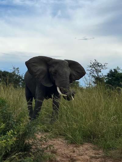
On 18 October 2024, travelling by boat along the Victoria Nile through Murchison Falls National Park, I saw what intact riverside wetland looks like when it has had decades of protection. The riverbanks were dense with vegetation — papyrus, riparian forest, grassy floodplain — and that vegetation was full of life. We spotted Nile crocodiles resting in the shallows, their extraordinary stillness broken only by the occasional slow drift of a tail. At one point the boat slowed near a large elephant standing at the water's edge, drinking. These animals were not novelties to be photographed through a telephoto lens from a distance: they were simply there, integrated into a landscape that had enough space and enough undisturbed habitat to support them.
Murchison Falls National Park protects approximately 3,840 square kilometres of savanna, riverine forest and wetland along the Victoria Nile — the stretch of river between Lake Albert and Lake Kyoga. The park is one of the few places in Uganda where the full suite of large mammal species associated with the Nile ecosystem still occurs: elephant, hippopotamus, Nile crocodile, lion, buffalo, giraffe and Uganda kob, alongside over 450 bird species. This diversity is not accidental. It reflects the protection of the wetland and riverine habitats that most of these species depend on.
The contrast with unprotected areas outside the park is instructive. The drive from Buhoma toward Murchison on 19 October 2024 passed through landscapes that showed every stage of the pressure cycle NSOER 2024 describes: smallholder farms running to the edges of seasonal streams, wetland margins drained and tilled, brick kilns set up in low-lying areas where clay was accessible. This is not unusual or exceptional land use in Uganda — it is the ordinary response of communities to land pressure and economic necessity. The overloaded minibus we saw transporting mattresses and household goods on that same road, its cargo stacked several metres above the roofline, was part of the same story: a country in motion, growing, building, requiring materials and infrastructure at a rate that its natural systems are being asked to support.
Uganda's Conservation Framework and the 2040 Target
Uganda has committed, in its national development planning framework, to achieving environmental resilience by 2040 through strategies centred on renewable energy, sustainable agriculture, and green infrastructure (NSOER 2024, Part 2). This is an ambitious target given the scale of current pressures, and NSOER 2024 is candid about the gap between stated goals and current trajectories. But the policy and legal framework that has been built over the past decade provides a more robust foundation than Uganda had at any previous point.
The Uganda Wetlands Management Program is the principal institutional mechanism for wetland protection and restoration. It oversees the mapping and demarcation of critical wetland areas, coordinates restoration interventions in priority catchments, and provides the monitoring data that feeds into environmental reporting. Uganda Wildlife Authority (UWA) regulations require that landfill operators submit environmental monitoring reports to UWA twice per year — a mechanism for keeping track of how waste management operations are affecting wetland systems near their sites (S.I. No. 49 of 2020, Part 4).
Uganda has also implemented three national initiatives targeting climate-smart agriculture, improved waste management, and sustainable tourism as interconnected responses to the environmental pressures NSOER 2024 documents (Part 2). The connection between these three domains is real: agriculture that uses fewer inputs and maintains soil cover reduces runoff into wetlands; better waste management reduces the industrial and municipal contamination that reaches rivers; sustainable tourism creates economic value from intact ecosystems that would otherwise face development pressure. Whether these initiatives translate to measurable change in wetland coverage and water quality over the next decade will be visible in the NSOER report that follows this one.
Mountain gorillas are among the species explicitly identified in NSOER 2024 as conservation priorities (Part 2). Their inclusion in an environmental status report alongside wetland degradation data is a reminder that Uganda's biodiversity challenges form a single interconnected system. The health of the forests that gorillas depend on influences the water that reaches Uganda's rivers and lakes. The health of those rivers and lakes influences the productivity of the fisheries that communities around Lake Victoria depend on. The health of those communities influences whether the next generation of Ugandans will have the means and the incentive to maintain the protected areas, wetlands and natural systems that everything else depends on.