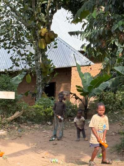
Three children appeared at the edge of the space where we were eating, in Buhoma on the morning of June 21, 2026. They were from the neighborhood near the local orphanage — slightly uncertain in their manner, their clothes worn, their appearance carrying the marks of genuine difficulty. They stood for a moment at the threshold. We invited them to eat without deliberation. That image — photographed at GPS coordinates -0.9617°N, 29.6109°E by Mark Suer and tagged at 06:32 that morning — is from Uganda's southwestern forest highlands, as far from Lake Victoria as you can travel within Uganda and still be in the same country. But the journey that brings visitors to Buhoma begins at the lake, and often ends there too.
Entebbe International Airport sits directly on Lake Victoria's northern shore. Every international visitor to Uganda lands on the lake's edge. Some continue immediately toward the interior — north to Murchison Falls, southwest to Bwindi and the mountain gorillas. But those who pause at the lake, and follow it west from Entebbe rather than leaving it behind, discover the Ssese Islands: 84 islands in Lake Victoria's northwestern section, accessible by ferry, offering a version of Uganda that no game drive or trekking permit can replicate. During visits in October 2024 and January 2026, I spent time around Entebbe and the northern Ugandan lakeshore — arriving and departing through the same airport, returning to the same equatorial shoreline each time. The Ssese Islands wait just a few hours offshore for any visitor willing to take the ferry.
This guide covers what the Ssese Islands are, how to reach them, what the experience of being there is actually like, and how they fit into a broader Uganda itinerary. It draws on the author's documented visits and on the Lake Victoria context built across this site. The photographs of Ssese Islands themselves load via the dynamic gallery below — the original photos taken in June 2026 for this article are from the same Uganda trip, from the forested southwest.
The Ssese Islands — 84 Islands in Lake Victoria
Lake Victoria is, according to the Uganda Bureau of Statistics Statistical Abstract 2014, the world's second largest freshwater lake and the source of the River Nile — the longest river in the world. Within this lake, on the Ugandan northwestern shore, lies the Ssese archipelago: 84 islands ranging from the large and partially forested to the small, low-lying, and uninhabited. They occupy a section of the lake that sits between the northern Ugandan shore (Entebbe, Kampala) and the open water of the lake's central basin, far enough from the mainland to feel genuinely removed from it, close enough to be reachable by regular ferry.
Bugala Island is the largest of the 84 islands and the practical base for almost all visitors. It is large enough to support a small road network, several communities, forested interior, and a scattering of accommodation ranging from basic guesthouses to eco-camps. The administrative capital of Kalangala District — whose jurisdiction covers the entire Ssese archipelago — sits on Bugala. Most of the island's activity concentrates along its eastern shore, facing the mainland, where the ferry piers are located and where most of the fishing communities and small hotels cluster. The western shore, less developed and more forested, gives a different impression of what the islands are.
Not all 84 islands are inhabited, and most are inaccessible except by private boat. The inhabited islands support communities that have lived from the lake for generations — fishing, transporting goods between islands, and more recently engaging with the small but growing tourism economy that the archipelago attracts. The islands collectively form Kalangala District, one of Uganda's most geographically distinctive administrative units: a district composed entirely of islands and the surrounding lake waters, with no continuous land border with any other district.
The lake surrounding the Ssese Islands is part of the same body of water that borders Entebbe Municipality and Wakiso District on the northern shore — a geographic continuity that makes the islands feel connected to the mainland even when the water between them is broad. On clear days, from the higher points of Bugala's interior, the mainland is visible to the north and east as a low line on the horizon. The lake is not, in these moments, an absence of land — it is a presence in itself.
Getting to the Ssese Islands — Ferry Routes and Crossing Times
The main vehicle ferry route to the Ssese Islands runs from Bukakata, on the western shore of Lake Victoria south of Masaka, to Luku on Bugala Island. This is the standard route for visitors travelling with a vehicle and the route most commonly used by Ugandans travelling to the islands for trade or family visits. From Kampala, reaching Bukakata involves driving south and then west — a journey of several hours depending on road and traffic conditions. The crossing itself takes longer than the more direct passenger routes from Entebbe, but it is the reliable option for anyone bringing a car onto the island.
Visitors based in Entebbe — which means most international arrivals, given that Entebbe International Airport is Uganda's only international entry point — have a more direct option. The passenger ferry from Nakiwogo pier, near Entebbe town, runs to Bugala Island across the open lake. This crossing is shorter in overland distance than the Bukakata route and more commonly used by backpackers and independent travellers who do not need to transport a vehicle. Journey times and schedules vary; checking current operating times locally before departure is essential, as lake ferry services operate on schedules that can shift seasonally and are not always updated on external websites.
The crossing itself — however you make it — is part of the experience. Lake Victoria is vast, and the Ssese Islands crossing gives visitors their first sustained encounter with the lake as open water rather than a backdrop to a shoreline town. The scale becomes apparent. The horizon is water in most directions. The air is different: cooler, carrying the particular freshness of a large body of fresh water. If the crossing conditions are good, which they generally are during Uganda's dry seasons, there is nothing unpleasant about the journey. If the lake is running a swell — possible during transitional weather — smaller boats can be uncomfortable. The dry season months of June to September, and to a lesser extent December to February, offer the most reliable crossing conditions.
Practical note: Confirm current ferry departure times locally on the day of travel. The Uganda Tourism Board has planned 20 docking piers across Lake Victoria's Ugandan shore as part of water transport infrastructure development — some are already operational, and this may improve access options to the Ssese Islands over the coming years.
The Landscape and Life of Bugala Island
Bugala Island is large enough to contain genuine variety. The forest that covers portions of the island interior is primary tropical forest — not plantation, not secondary growth, but the kind of dense, layered canopy ecosystem that preceded human settlement across much of equatorial Africa. Walking into it from the island's tracks is to move through a sequence of ecological transitions: the fishing village at the water's edge, the small farms and kitchen gardens behind the houses, the secondary scrub and regenerating forest where fields have been left fallow, and then, further in, the high canopy with its characteristic low light, cool air, and near-silence except for birds.
The birds are a significant reason to visit the Ssese Islands independently of beach and forest. Lake Victoria and its islands sit within one of East Africa's most species-rich avifaunal zones. The forest interior hosts species rarely seen in more accessible habitats; the shoreline and papyrus fringing the lake edges attract water birds and specialists of the lake margin. Birdwatching on the Ssese Islands rewards patience and an early start in the same way that it does everywhere in Uganda — and Uganda, across repeated visits between October 2024 and June 2026, has delivered more unplanned wildlife encounters per hour of outdoor time than anywhere else in East Africa that I have visited.
The beaches of Bugala Island are freshwater beaches on a tropical lake at 1,133 metres above sea level. They are not Caribbean beaches — the colour of the water is not turquoise, and the sand is not white powder — but they are genuinely beautiful in a more restrained way, and the experience of swimming in Lake Victoria or simply sitting above the water watching it is unlike any other in East Africa. The health caveat applies: bilharzia is present in many parts of Lake Victoria, and visitors should ask locally before entering the water. The managed beach areas that lodges and camps maintain tend to be monitored, but the lake is large and variable, and caution is appropriate.
The fishing communities on Bugala and the inhabited smaller islands are the economic and cultural engine of the archipelago. Fishing on Lake Victoria is not a heritage industry maintained for tourism — it is a working economy that operates before dawn every day. The boats go out in the dark and return in the morning. The catch goes immediately to processors and buyers at the landing sites, where it is sorted, weighed, and either sold locally or prepared for the export trade that ships Nile perch fillet to European and East Asian markets. For a visitor with time to simply watch this process — arriving at a landing site around sunrise and staying long enough to see the boats come in — the Ssese Islands offer access to a dimension of Lake Victoria life that the beaches and forest walks alone do not show.
[QUOTE: Ssese Islands fisherman or lodge owner on what makes the islands different from the mainland — to be collected on next visit]
The Ssese Islands in Uganda's Wider Lake Victoria Context
The Ssese Islands do not exist in isolation. They are part of the same lake system that generates everything from the Source of the Nile at Jinja in the northeast to the papyrus swamps of Mabamba in the northwest where the shoebill stork is most reliably found. Mabira Forest Reserve — 306 km² of protected tropical forest established in 1932, 54 km east of Kampala — sits near the lake's northern shore and represents the same forest ecosystem type, at slightly lower elevation, as the island forest on Bugala. Understanding the Ssese Islands means understanding them as part of this broader equatorial forest and lake mosaic, not as isolated curiosities.
The relationship between the islands and Entebbe is practical as well as geographic. Entebbe — which sits at the tip of a peninsula directly on Lake Victoria's northern shore, and which hosts Uganda's only international airport — is the gateway through which all international visitors pass. From Entebbe, the Ssese Islands are a half-day's journey by ferry. Entebbe Municipality borders Lake Victoria directly, as do the broader communities of Wakiso District that extend west and north of Entebbe along the lakeshore. The infrastructure investment that the Uganda Tourism Board has been driving — the planned 20 docking piers across the Ugandan lakeshore — has the potential to make the ferry connection between Entebbe and the Ssese Islands faster and more reliable than it currently is.
The islands also connect, less obviously, to the gorilla trekking circuit in southwest Uganda. Visitors who spend two or three nights on the Ssese Islands before driving south and west to Bwindi are following a Uganda itinerary that uses the lake as a decompression — a place to adjust from the pace of international travel before moving into the demanding highland terrain of gorilla country. During our January 2026 trip, which combined Entebbe lake time with gorilla trekking at Bwindi, the transition between the flat equatorial lakeshore and the corrugated southwestern highlands made the contrast between the two environments vivid in a way that a direct arrival in Bwindi would not have. The lake belongs at the beginning.
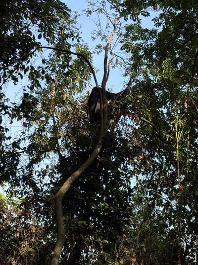
During our gorilla trekking in January 2026, we found the first gorilla family after roughly an hour of walking. The first animal we saw was sitting in a tree, feeding on leaves with complete unhurriedness. That experience is 400 kilometres from Lake Victoria's shore, and it is the reason most international visitors come to Uganda at all. The Ssese Islands are the version of Uganda that exists before and after that encounter — a place to breathe, to be on the water, to eat fresh fish in the evening with the lake visible from wherever you are sitting. They are not a consolation for visitors who cannot afford gorilla permits. They are a destination in their own right, and they happen to combine very naturally with every other reason to be in Uganda.
Planning Your Ssese Islands Visit
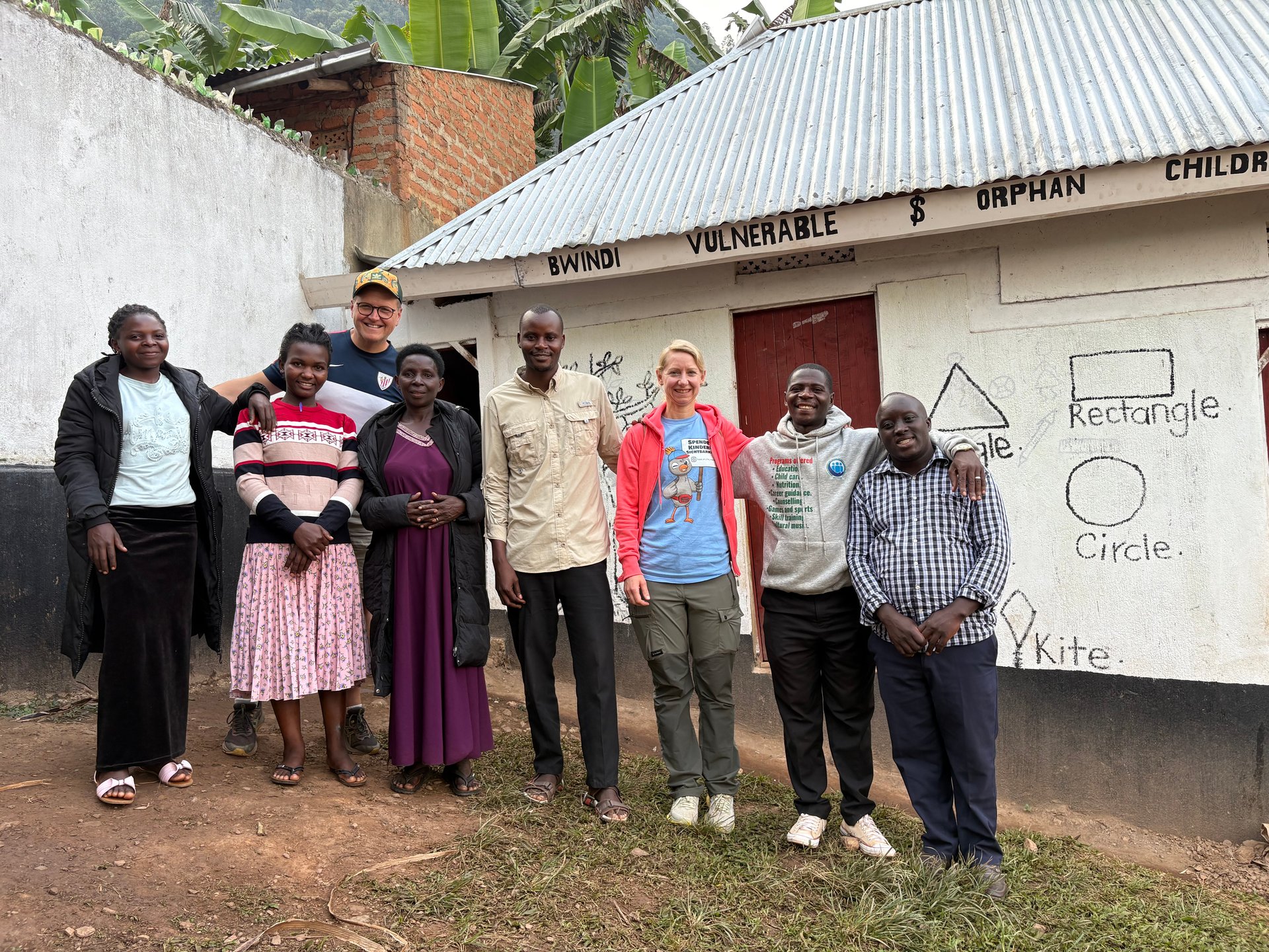
The optimal time to visit the Ssese Islands is June to September, during Uganda's long dry season. The ferry crossings are most reliable in this period, the forest trails on Bugala are dry enough to walk without difficulty, and the weather pattern is predictable enough for multi-day planning. My June 2026 Uganda trip — documented across three GPS-tagged photographs on the 21st — began during this window. The mornings in southwest Uganda were clear and cool; conditions on Lake Victoria's northern shore, experienced on the drive through Entebbe to and from the airport, showed the same calm characteristic of the dry season. December to February is Uganda's shorter dry season and also a practical time for the Ssese Islands.
The rainy seasons — March to May (the long rains) and October to November (the short rains) — are not impossible periods for the islands, but ferry services can be disrupted and the forest trails on Bugala become muddy and slippery. October 2024 visits to the Entebbe area fell in the short rains period and gave a direct experience of how quickly the landscape transforms in wet conditions — the lakeshore vegetation becomes intensely green, the air humid and heavy, and afternoon showers a daily expectation. For visitors primarily interested in beach time and forest walks, the dry season months are clearly preferable.
How long to stay on the Ssese Islands is a question of itinerary balance rather than of how much there is to do. Bugala Island can occupy three or four days comfortably for visitors who engage with the fishing communities, do the forest walks, spend time on the water, and use the slower rhythm of island life as a deliberate change of pace. A single night is too little — the ferry crossings consume significant time, and one night leaves no room for the kind of unplanned encounter that makes island travel worth doing. Two nights is the minimum for the Ssese Islands to register as a place rather than a transit point. Three or four nights is enough to feel like a stay rather than a visit.
Accommodation on the Ssese Islands ranges from basic guesthouses in Kalangala town to eco-camps and small lodges in quieter parts of Bugala's shoreline. The choice between staying in town — with easier access to the ferry pier, the markets, and the morning fish landings — and staying at a more remote beach camp is a choice between two different kinds of islands experience. Visitors primarily interested in the community and fishing life of the islands will find Kalangala itself more revealing. Visitors primarily interested in the forest, the beach, and the lake horizon will find the smaller properties on quieter stretches of shore more satisfying. Both options are worth knowing about; the choice depends on the type of stillness you are looking for. [RECHERCHE NOETIG: specific lodge names and current pricing for Bugala Island accommodation]
Getting from the Ssese Islands back to Entebbe and the airport is the logistical consideration that governs the islands' place in any itinerary. The ferry crossing and the onward road to Entebbe Airport need to be factored into departure day planning. Visitors flying out on a tight international connection should plan the Ssese Islands stay as an early itinerary element — arriving after an initial Entebbe orientation day and leaving with enough buffer before a critical flight. For visitors with flexible departures, the ferry schedule is less constraining. The advice that applies to all lake ferry travel in Uganda applies here: confirm current times locally, build buffer, and do not plan a critical departure to depend on a single ferry.