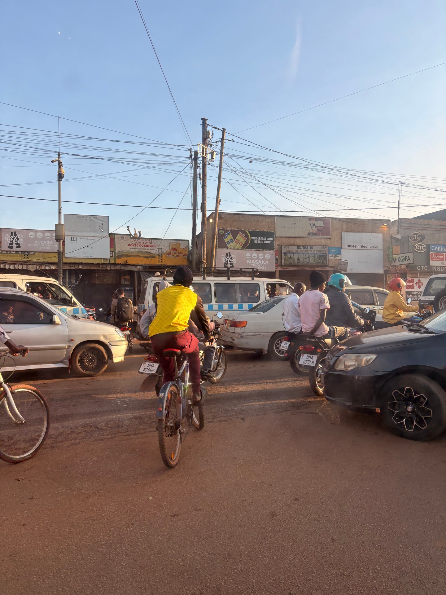
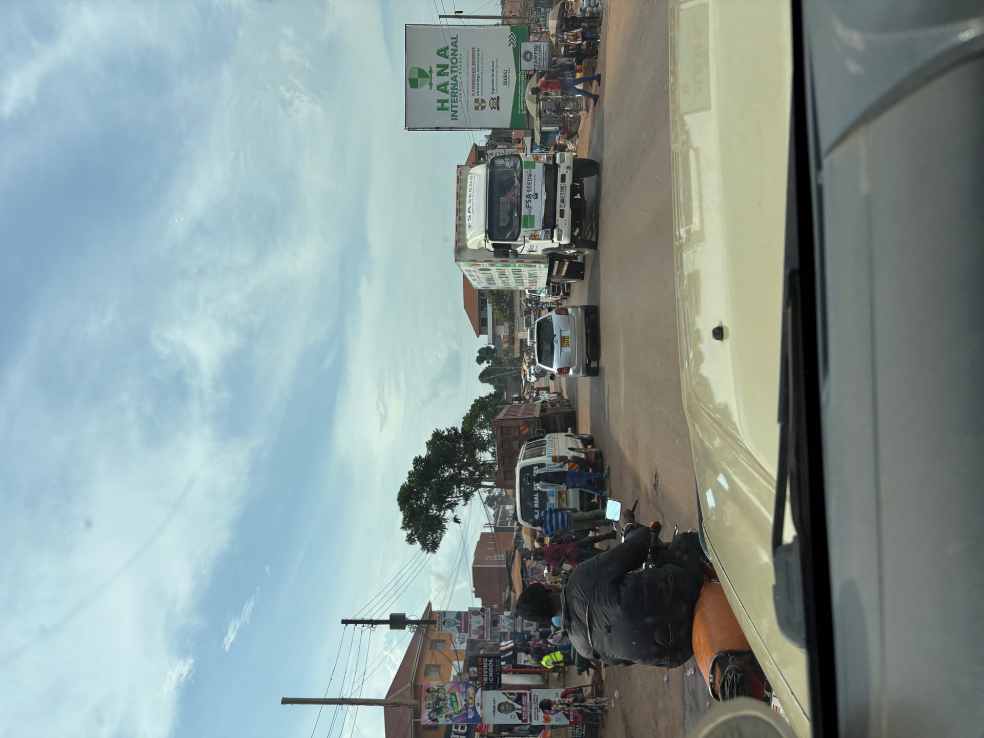
After we were collected from Entebbe Airport, the drive took us straight through Kampala. The capital was packed: vehicles crossing the road from every direction, boda bodas (motorcycle taxis) threading through gaps that looked too narrow for anything, street-side stalls running for kilometre after kilometre along the road. There was nothing slow or subdued about it. This was my 4-day first pass through Uganda's urban corridor in October 2024, and the density of it — the noise, the movement, the commerce happening at the roadside at every hour — was the first real impression of a country built around activity rather than stillness.
What that drive also gave us, before we had reached Kampala, was a first look at Lake Victoria. On the final approach from Addis Ababa on Ethiopian Airlines, the lake appears beneath the aircraft's wing as a vast flat sheet of water framed by green hills and red laterite roads. From the air it looks exactly as large as it is — 68,800 square kilometres, the largest lake in Africa and the world's largest tropical lake. Entebbe Airport sits on a peninsula jutting into the lake, which means Lake Victoria is the literal first thing you see of Uganda. It is impossible to arrive by air without crossing it.
This guide covers the practical side of that experience: how to move from the airport to the lake activities most visitors come for, what Kampala actually feels like as a transit hub, and what is available on and around the lake within a day's reach of Entebbe.
Arriving at Lake Victoria — Entebbe Airport and the First Hours
Entebbe International Airport serves as Uganda's main international gateway. In January 2026 and October 2024, I arrived here twice — once in the early morning after an overnight flight, once in the afternoon after a connection through Addis Ababa. Both times, the arrangement that works best is a pre-arranged pick-up: a driver with a sign, a vehicle already waiting, no negotiating required in a tired, jet-lagged state. In January 2026, the pick-up was a safari jeep — the kind of vehicle with a roof rack and a high clearance that is characteristic of Uganda's tourism infrastructure, robust enough for the road conditions outside the capital.
The area around Entebbe Airport is already on Lake Victoria. The drive from the terminal to Entebbe town takes about ten minutes along a road that skirts the lakeshore, with water visible through the vegetation on the right. For visitors whose entire Uganda trip is lake-focused, it is possible to stay in Entebbe and never need to enter Kampala at all: the boat departure point for Ngamba Island Chimpanzee Sanctuary is in Entebbe, the Mabamba Bay wetlands (home to the shoebill stork) are about 45 km further along the shore, and the Ssese Islands ferry departs from Nakiwogo Landing near Entebbe.
For most visitors, however, Kampala is unavoidable — it is the transport hub for destinations across Uganda, and most accommodation, car hire operators and tour companies are based there. The drive from Entebbe to Kampala covers about 40 km and takes between 45 minutes and two hours depending on traffic conditions.
Kampala — The Urban Gateway to the Lake
Kampala is organised into five administrative divisions: Central, Nakawa, Makindye, Lubaga and Kawempe (Multi-Hazard Risk and Vulnerability Profile, 2018). Central Division is surrounded by all the others and contains the main commercial district, government ministries and the majority of the city's hotels. The city generates approximately 65% of Uganda's national GDP — a figure that explains both its density and its traffic. A city doing that proportion of a country's economic work in a relatively compact urban footprint is, necessarily, a city in constant, loud motion.
The boda boda is the defining vehicle of Kampala's street life. These motorcycle taxis — the name derives from the Swahili word for "border to border," reflecting their origin as cross-border transport in the 1980s — operate on every road in the city, threading through gridlocked traffic with a speed that no car can match and a safety record that reflects the conditions. In October 2024 in Jinja, a few hours east of Kampala on Lake Victoria's northern shore, we took a boda boda through town with the Butiru Freundeskreis — three people on a single motorcycle, no helmets, light shoes, moving through traffic that a European city would have regulated into impossibility. It is entirely normal in Uganda, and it works, though visitors accustomed to European traffic conventions will find the first ride memorable.
Kampala sits approximately 1,200 metres above sea level and has a moderate equatorial climate, its temperatures regulated partly by its proximity to Lake Victoria. The city's annual temperature variation is only about 2.1 degrees Celsius. What it lacks in temperature extremes it compensates for in rainfall variation: April is the wettest month (around 169 to 180 mm), and the city's drainage infrastructure struggles with the volume, producing periodic flooding in low-lying areas near the lake (Multi-Hazard Risk and Vulnerability Profile, 2018). Kampala's Multi-Hazard Risk assessment (2018) rated human epidemics as high risk for the city, partly linked to water quality challenges in areas near the lake's northern shore.
For the lake-focused visitor, Kampala's main relevance is logistical: it contains the best accommodation options, the main tour operators, the primary vehicle hire companies, and the transport connections to the rest of Uganda. The Uganda National Museum, located 3 km from the city centre along Kiira Road (Multi-Hazard Risk and Vulnerability Profile, 2018), and the Kasubi Tombs — a UNESCO World Heritage Site and burial place for Buganda Kingdom's kings — are the two most significant cultural sites within the city. Both are accessible as half-day excursions from any centrally located accommodation.
What to Do on Lake Victoria from Entebbe
The activities available from Entebbe cover a broad range, from wildlife-focused boat trips to beach days to birdwatching. The lake is the consistent backdrop for all of them.
Ngamba Island Chimpanzee Sanctuary
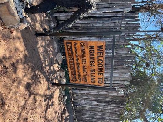
The boat crossing to Ngamba Island takes approximately 45 minutes from Entebbe's waterfront. The island, managed by the Chimpanzee Sanctuary and Wildlife Conservation Trust (CSWCT), is home to around 50 rescued chimpanzees living in 98 acres of forested territory. In October 2024, the arrival was marked by a welcome sign — hand-painted in warm orange tones on weathered wood — that was, as the sign suggested, genuinely welcoming. The island does not feel like a managed tourist facility. It feels like a working sanctuary that happens to have visitors. The boat crossing itself passes over open lake water, and on the way back you see the Ugandan shoreline differently: the green hills, the settlements, the distance between the world the chimpanzees live in and the world on the other side.
Mabamba Bay and the Shoebill
The Mabamba Bay wetland on Lake Victoria's northwestern shore, about 45 km from Entebbe by road and boat, is Uganda's most reliable location for shoebill stork sightings. The shoebill (Balaeniceps rex) — a large, distinctive bird with a shoe-shaped bill that evolved to catch lungfish in papyrus swamps — is one of the most sought-after species in African birdwatching. Guided canoe trips through the papyrus swamps of Mabamba Bay operate in the early morning, when sightings are most frequent and the light is best. [VOICE FEHLT: local guide on shoebill behaviour]
Entebbe Botanical Gardens and Lido Beach
The Entebbe Botanical Gardens run along the lakeshore and contain original forest patches from the colonial period, including specimens of tropical hardwood and a lakeside path with views toward the Ssese Islands. Several sequences from film productions were shot here — the forest is particularly intact for an urban botanical garden. Lido Beach, close to the gardens, is one of the more managed beach access points on Lake Victoria in Uganda; the water here is monitored more regularly than at informal shoreline access points, making it a relatively lower-risk option for swimming, with the caveat that bilharzia risk is present throughout the lake.
The Ssese Islands
The Ssese archipelago — 84 islands in Lake Victoria's Ugandan portion — is reachable by ferry from Nakiwogo Landing near Entebbe (roughly 2 hours) or by a faster private boat. The islands retain significant forest cover and a character quite different from the mainland: slower pace, fishing villages, sandy beaches, and the particular quiet that comes from being surrounded by water. The crossing itself, particularly on the larger vehicle ferry, offers extended time on open lake and views of the islands' approach.
Water Quality and Practical Lake Safety
Uganda's Multi-Hazard Risk and Vulnerability Profile (2018) recommended that water quality assessments be conducted monthly in Kampala's lake-adjacent areas to monitor pollution levels and public health risks. It also recommended detailed site-specific assessments around identified pollution point sources — areas where industrial effluent, medical waste or urban runoff enters the lake or its connected wetlands. These are formal recommendations from a risk assessment commissioned with UNDP support across 111 Ugandan districts — they reflect real documented concerns rather than generic precaution.
For visitors, the practical implications are straightforward: Lake Victoria is not a lake you swim in casually at any point along its shoreline. The bilharzia parasite is present across the lake. Water quality varies significantly between managed recreational areas with regular monitoring and unmanaged shoreline areas near urban centres. The Entebbe area — because it is a peninsula with relatively open water circulation — generally has better water quality than the Kampala harbour areas at the northern end of Murchison Bay, where urban drainage and industrial activity are most concentrated. Invasive species — water hyacinth in particular — are most heavily concentrated in the Murchison Bay area around Ggaba, Salama and Buziga (Makindye Division) and in Luzira (Nakawa Division), both of which are urban fringe areas rather than visitor destinations (Multi-Hazard Risk and Vulnerability Profile, 2018).
The lake's open water, away from urban shorelines, is a different environment entirely. The crossing to Ngamba Island in October 2024 was across clean, clear, open water — the kind of crossing that makes the scale of Lake Victoria viscerally real. The lake is too large to see across in any direction. The horizon is water, in every direction, until the island appears. That experience — of being in the middle of something larger than the context of daily life usually accommodates — is one of the things Lake Victoria reliably delivers.
Practical Tips — Getting Around from Entebbe and Kampala
- Airport transfer: Pre-arrange a pickup. Safari vehicles are comfortable and practical for luggage. Taxis are available but negotiate the fare before departure.
- Kampala transit: Budget 90 minutes minimum for any cross-city drive. Boda bodas are fast but carry risk — use them only if you're comfortable with the conditions.
- Ngamba Island: Book in advance through CSWCT. Trips depart in the morning. Bring sunscreen and a light waterproof layer for the open crossing.
- Mabamba Bay shoebill: Depart early — 06:00 to 08:00 for best sighting chances. Arrange through a registered guide or Entebbe-based tour operator.
- Swimming: Use managed beach facilities (Lido Beach, Entebbe) rather than unmonitored shoreline points. Bilharzia risk is real throughout the lake.
- Best months: December to February and June to August for calmer lake conditions and lower rainfall.