From Buhoma to the Lake Shore
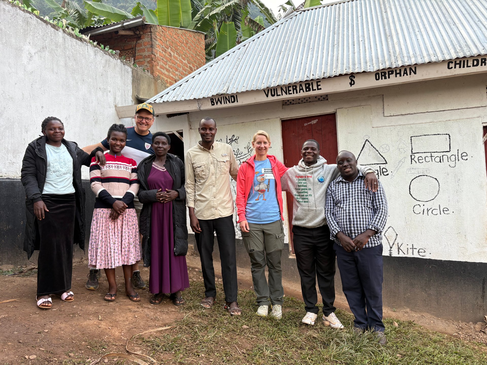
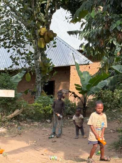
Three children stood outside a simple mud-brick building in Buhoma in June 2026 — slightly shy, their clothing and posture carrying the visible weight of difficult circumstances. Within minutes they were sitting with us, eating together. That moment, GPS-documented at coordinates -0.9617, 29.6109, captures something fundamental about Uganda: the human reality coexists with the extraordinary natural landscape, and neither can be understood without the other.
The journey from that hillside in southwest Uganda to the shores of Lake Victoria covers roughly 600 kilometres and passes through landscapes shaped entirely by the lake's presence. The rainfall that sustains Bwindi's forest comes from moisture cycling off East Africa's lake system. The river that begins its 6,650-kilometre journey to the Mediterranean at Jinja is fed by the same catchment. Lake Victoria is not just a body of water — it is the hydrological engine of an entire region.
According to the Uganda Bureau of Statistics Statistical Abstract 2014, Lake Victoria is the world's second largest freshwater lake and the source of the River Nile, which is the longest river in the world. This rank — second only to Lake Superior in surface area — makes Lake Victoria an object of global significance. For Uganda, Kenya, and Tanzania, it is the organising principle around which much of their modern economies have been built.
During multiple visits to Uganda between October 2024 and June 2026 — totalling over 59 days across 14 documented on-site stays — the patterns of how the lake shapes daily life became increasingly clear. Every town near the shore organises its economy around the lake. Every national park in the region draws its ecological character from the lake's rainfall influence. Every major infrastructure project — roads, dams, ports — is calibrated around the lake's presence or absence.
Tourism on Lake Victoria: Uganda's Growing Tourism Economy
Tourism is one of Uganda's largest export earners — a sector that creates jobs, generates foreign currency, and attracts infrastructure investment in ways that few other industries can match. The Uganda government's statistical framework for tracking the sector, documented in the annual Statistical Abstracts published by the Uganda Bureau of Statistics, classifies tourism alongside wildlife and cultural heritage as the primary drivers of international visitor spending.
Lake Victoria sits at the centre of this tourism geography. Entebbe, where Uganda's only international airport is located, sits directly on the lake's northern shore — about 40 kilometres south of Kampala. Almost every international visitor to Uganda arrives by flying over Lake Victoria and landing beside it. The lake is the first significant thing most visitors see from the air and often the first thing they encounter on the ground.
The Entebbe peninsula's position on Lake Victoria creates a distinctive travel experience. The international airport is within 15 minutes of the lake shore. The Ugandan Wildlife Authority's Ngamba Island Chimpanzee Sanctuary lies 23 kilometres offshore by boat — one of the most accessible chimpanzee habitats in East Africa. The Mabamba Bay Wetland, 50 kilometres from Entebbe along the lake shore, is the primary destination in Uganda for shoebill stork observation. These three experiences — airport proximity, chimpanzee sanctuary, and shoebill wetland — make the Entebbe section of Lake Victoria's northern shore one of the most tourism-dense stretches in East Africa.
The Entebbe area also holds a geographically remarkable marker: the equator crosses the Lake Victoria shore here, and the Kigungu area holds significant historical weight as the landing site of the first Catholic missionaries in Uganda, Father Lourdel and Brother Amans, who established their first centre at what is now the Kigungu Catholic Shrine. The nearby Entebbe za Mugula — the traditional seat of Mugula, the chief who governed this territory before colonial administration — adds a further layer of cultural history to a shoreline most visitors experience primarily as a gateway rather than a destination. An equator assessment and brand development project identified these sites as underutilised tourism assets, noting that current infrastructure for visitors falls well below international standards and that 20 planned water transport jetties around the Ugandan lake shore could significantly expand access.
The Ssese Islands — 84 islands in the lake's northwestern quadrant, accessible by ferry from the Nakiwogo pier near Entebbe or Bukakata on the mainland — represent Uganda's most developed island tourism product. Kalangala, the administrative centre on Bugala Island, has grown from a fishing village into a small town with accommodation options ranging from camping at beach resorts to mid-range lodges. The Ssese Islands attract visitors seeking isolation, beaches, and birdlife relatively close to Kampala — a roughly three-and-a-half-hour ferry journey from Nakiwogo to Kalangala, with the ferry operating daily at 14:00 from Nakiwogo and departing at 08:00 from Kalangala on the return.
[QUOTE: local lodge owner on what draws visitors to Ssese compared to mainland destinations]
Water, Hydropower, and Agriculture: The Lake's Resource Value
Tourism is only one dimension of Lake Victoria's economic significance. The lake underpins Uganda's entire energy system through the hydropower plants on the Victoria Nile at Jinja. The Nalubaale Dam — built at the site of the original Ripon Falls where John Hanning Speke first confirmed the Nile's source in 1862 — was completed in 1954 as the Owen Falls Dam. The adjacent Kiira Dam was completed in 2003. Together, Kiira and Nalubaale generate approximately 380 MW of installed hydroelectric capacity and have historically supplied the majority of Uganda's grid electricity.
This dependence on a single hydrological system creates a structural vulnerability. When Lake Victoria's water level drops — as it did significantly in the early 2000s and has done again during extended dry periods — power output falls and load shedding becomes unavoidable. The lake's water level is determined by the balance between the roughly 90% of its input that comes from direct rainfall and the outflow through the Nile. During sustained droughts in the catchment, the lake can fall by measurable amounts within a single year, reducing the hydraulic head available to the turbines at Nalubaale and Kiira.
Uganda has responded to this vulnerability by diversifying its power generation. The Tillenga Gas Power Project in Bulisa District, with 80 MW installed capacity and planned commissioning from 2025, and the Kingfisher Gas Power Project in Kikuube District, with 53.7 MW capacity and a similar timeline, represent deliberate steps toward reducing dependence on Lake Victoria's water level. The Lisimba project adds a further 180 MW of generation capacity. Winch Energy Uganda operates 31 off-grid solar sites across Bunjako and Lamwo, extending electricity access to communities that the grid does not reach.
Agriculture is the largest single consumer of Uganda's water resources and the sector most directly affected by Lake Victoria's condition. Rainfed agriculture — the predominant farming model for the approximately 75% of Ugandans whose base income comes from the land — depends on the rainfall patterns that Lake Victoria's evaporation helps generate. The lake and its surrounding wetlands provide the moisture that feeds the bimodal rainfall pattern across much of Uganda: the long rains from March to May and the short rains from October to November. Disruptions to the lake's evaporation — from surface temperature changes, reduced water area, or altered vegetation — propagate into the rainfall patterns that farmers depend on.
Livestock farming consumes substantial water resources across Uganda's cattle corridor — the arc of drier land running from southwest to northeast that passes through districts including Mbarara, Kiruhura, and Nakaseke. Irrigation agriculture, while less common than rainfed systems, draws on both surface and groundwater in formal irrigation schemes. The Water Supply, Sewerage and Waste Management sector, covering municipal water utilities and industrial wastewater, rounds out the picture of how comprehensively the lake's basin underpins Uganda's economy.
The lake's fisheries sector is the most visible economic activity to any visitor who travels through lakeshore communities. Nile perch — introduced in the 1950s in a controversial decision that transformed the lake's ecology — is now Uganda's primary freshwater fish export. Processing factories around the lake employ tens of thousands of workers. Tilapia fishing supports smaller-scale local markets. The combined fish export sector generates hundreds of millions of dollars annually for Uganda, Kenya, and Tanzania, though the ecological costs — including the extinction of several hundred endemic cichlid species following the Nile perch introduction — have been severe and are not easily reversed.
The Lake's Ecological Status and Long-Term Threats
Lake Victoria's ecological balance has been stressed for decades. The primary pressures are well-documented: destruction of the original shoreline vegetation through agricultural expansion and settlement; eutrophication from agricultural runoff and domestic wastewater; the introduction and spread of water hyacinth (Eichhornia crassipes), a South American plant that arrived in the lake in the 1980s and can form dense mats covering entire bay areas; and the ongoing effects of the Nile perch introduction on the lake's native fish biodiversity.
The eutrophication dynamic is driven by phosphate and nitrate inputs from agricultural land and unprocessed sewage. When nutrients enter the lake at elevated concentrations, algae proliferate. The resulting algal blooms reduce water clarity, consume dissolved oxygen as they decay, and create conditions harmful to fish and other aquatic organisms. The problem is cyclical: as shoreline forests are cleared for agriculture or settlement, the buffer that would otherwise filter runoff before it reaches the lake disappears, accelerating nutrient input.
Water hyacinth was identified as a severe problem in the 1990s when it covered substantial portions of Uganda's lake shoreline, blocking boat access, reducing dissolved oxygen, and providing habitat for disease vectors including mosquitoes and snails associated with schistosomiasis. Biological control using weevil species (Neochetina eichhorniae and Neochetina bruchi) has reduced the coverage significantly since the late 1990s, but water hyacinth remains present in nutrient-rich bays and re-expands during periods of high rainfall and nutrient loading.
The lake's water level has attracted scientific attention over the past two decades. Lake Victoria's surface sits at approximately 1,133 metres above sea level, but this level fluctuates with rainfall and outflow management. A shallow lake at continental scale — with an average depth of only 40 metres — is more vulnerable to evaporation than deeper systems. The Uganda government's Ministry of Water and Environment has documented a trend of declining water levels that affects not only hydropower generation but also the depth available to ferry routes, the accessibility of fishing grounds, and the condition of the shallow wetland areas that ring much of the lake's shore.
Visiting Lake Victoria Uganda: Practical Information
Entebbe is the practical starting point for most Lake Victoria experiences in Uganda. The international airport sits directly on the lake shore, and the town itself is considerably calmer than Kampala — many travellers use Entebbe as their base for the first and last nights of a Uganda trip, with easy access to the lake, the Ngamba Island chimpanzee sanctuary, and the Mabamba Bay wetland for shoebill observation.
The Ssese Islands are the primary destination for travellers seeking an extended lake experience. The Nakiwogo ferry operates from a pier south of Entebbe, with the crossing to Kalangala on Bugala Island taking approximately three and a half hours. A first-class ticket costs around UGX 15,000. Accommodation on Bugala ranges from simple guesthouses in Kalangala town (Upland Guesthouse, Dream Land Guesthouse) to beach resorts with camping (Victoria Forest Resort, Mirembe Resort Beach — camping from USD 10, cottage accommodation from approximately USD 90 per night). Restaurants in Kalangala serve fresh fish from the lake and basic Ugandan dishes.
Jinja offers the most adventure-oriented lake experience — the Source of the Nile boat trip, white-water rafting on the Victoria Nile, bungee jumping, kayaking, and mountain biking. From Jinja, the lake itself is less visible than at Entebbe, but the river provides a direct connection to it: every drop of water in the Nile below Jinja began its journey in Lake Victoria. The drive from Kampala to Jinja is 80 kilometres, typically 1.5–2 hours.
The Uganda Wildlife Authority (UWA) manages much of the conservation infrastructure around Lake Victoria's shore. Their offices at Plot 7, Kira Road, Kamwokya, Kampala handle permits, park information, and activity bookings for lake-adjacent protected areas. Planning any lake-related activity in advance — particularly Ngamba Island chimpanzee sanctuary visits, which require advance booking — significantly improves the experience.