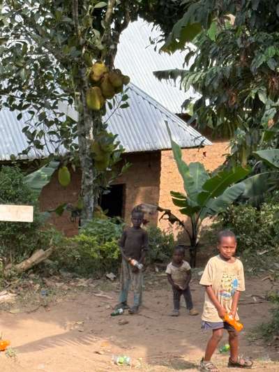
On an early morning in June 2026, not far from the Buhoma orphanage in southwestern Uganda, three children from the surrounding neighbourhood appeared at our door. They were shy and visibly uncertain — their clothes worn, their posture cautious in the way that children are when they have learned to be careful around strangers. We invited them in to eat without hesitation. That moment, GPS-tagged at coordinates -0.9617, 29.6109 and photographed by Mark Suer, is a small and specific human truth about East Africa: generosity and vulnerability exist in close proximity, and Lake Victoria — Africa's largest lake, the water that defines the region — is the backdrop against which much of this reality plays out.
Lake Victoria in Africa is not simply a geographical superlative. It is the inland sea that separates and connects Uganda, Kenya and Tanzania. It is the source of the White Nile. It feeds hundreds of fishing communities, regulates rainfall patterns across a region that stretches from the equator to the rift valleys, and sits at the centre of an increasingly complex set of governance arrangements designed to protect it for future generations. Over eleven days in October 2024, and again during visits in January and June 2026, I travelled extensively around Uganda's Lake Victoria shoreline — from Entebbe's botanical gardens at the water's edge to Kasenyi fishing village, from the Ssese Islands ferry landing to the quiet coves east of Kampala. This is what first-hand observation of East Africa's lake region shows.
Africa's Largest Lake — Scale, Shape and Place on the Continent
Lake Victoria covers approximately 68,800 square kilometres — an area larger than Ireland, roughly the size of the Republic of Croatia. It is Africa's largest lake by surface area and the world's largest tropical freshwater lake. Those facts appear in every encyclopaedia, but they do not fully convey the lake's presence. Approaching Entebbe by air, the water appears beneath the flight path as something more oceanic than lacustrine: a grey-blue expanse that absorbs the horizon, interrupted only by the dark dots of islands and the faint line of the Tanzanian shore in the far distance.
Despite its enormous surface area, Lake Victoria is relatively shallow. Average depth is around 40 metres, and the maximum recorded depth is approximately 84 metres. By comparison, Lake Tanganyika — Africa's second largest lake by surface area, lying to the southwest — reaches over 1,470 metres at its deepest point, making it the world's second deepest lake after Russia's Baikal. Lake Victoria and Lake Tanganyika occupy the same East African region but represent entirely different ecological environments: Tanganyika is a deep rift lake with extraordinary biodiversity developed over millions of years of isolation; Victoria is a younger, shallower, more turbulent body of water whose ecology has been dramatically altered by human activity in the twentieth century.
The lake sits on the East African plateau at an altitude of roughly 1,134 metres above sea level. Its catchment basin — the territory whose rivers and rainfall drain into it — extends across all three bordering countries and encompasses a large portion of the East African highlands. This basin, known as the Lake Victoria Basin, covers over 180,000 square kilometres, a geography that makes the lake's water quality and ecological health inseparable from land management decisions made hundreds of kilometres from the shore.
Murchison Bay and the Uganda Shoreline
Uganda's portion of Lake Victoria includes Murchison Bay, a large indentation of the lake that curves into the country's southern flank near Kampala and Mukono. According to Uganda's Statistical Abstract 2019, Kampala directly borders Lake Victoria — Africa's largest lake in East Africa — and the city is surrounded to the west and north by Wakiso District. This geography matters practically: Kampala's storm drainage, industrial effluent, and urban runoff all ultimately reach Murchison Bay, making the bay one of the most ecologically stressed sections of the lake despite being one of the most economically important.
Uganda's southern coastline also includes Kasenyi, a fishing village approximately eight kilometres east of Entebbe on a peninsula below the Kampala road. Kasenyi is one of the working lake's most accessible faces: wooden boats, nets spread across the sand, the smell of tilapia drying in the afternoon sun. On a visit in October 2024, the landing site was active from before dawn — a rhythm that has structured life on this shore for generations and that will continue well beyond any tourism initiative.
[QUOTE: local fisherman at Kasenyi on how the lake has changed in the past decade]The Three Nations That Share Lake Victoria
No other large lake in Africa is shared by three countries to the degree that Lake Victoria is. The political and logistical implications of this shared ownership shape almost every significant decision about the lake's future: fishing quotas, conservation zones, shipping routes, water withdrawal rights, and environmental protection all require coordination across national governments that sometimes have competing economic priorities.
Uganda — The Northern and Western Shore
Uganda controls the northern and western shorelines, including the critical Jinja outflow where the White Nile begins its 3,800-kilometre journey to the Mediterranean. The Ugandan shore contains the highest concentration of the lake's tourism infrastructure: the Ssese Islands, with their forest-covered interiors and quiet beaches; the Ngamba Island Chimpanzee Sanctuary, accessible by boat from Entebbe; and the commercial ferry connections that make island life viable. Uganda is also home to the lake's largest city at the waterfront: Entebbe, which serves as an international gateway and whose botanical gardens and beaches provide the most accessible encounter with Lake Victoria for most first-time visitors.
The Entebbe Golf Club — an eighteen-hole course on the lakeshore that claims to be the first in East Africa, founded over a century ago — is among the more unlikely testaments to colonial-era settlement patterns around the lake. More significantly for contemporary visitors, Entebbe's Aero Beach and the shoreline lodges along the peninsula offer a relaxed base from which the lake becomes a daily presence rather than a day-trip destination. On visits in January and May 2026, the mornings along Entebbe's northern shore were consistently calm and clear — the best time to be on the water is before noon, when afternoon storms can develop with little warning.
Tanzania — The Largest Shore
Tanzania holds the largest share of the Lake Victoria shoreline, encompassing the southern and southeastern sections. Mwanza is Tanzania's principal lake city — a substantial port with ferry connections to Kampala via the MV Victoria and the historic MV Bukoba service. Tanzania's lake economy is heavily dependent on Nile perch exports, and its fisheries management policies have been a frequent point of negotiation with Uganda and Kenya within the Lake Victoria Fisheries Organisation (LVFO).
Kenya — Kisumu and the Eastern Shore
Kenya's lake territory is smaller in area than Uganda's or Tanzania's, but includes Kisumu, the country's third largest city and its main inland port. Kisumu sits on Winam Gulf, a long inlet that extends eastward from the main lake body. The city has historically been the hub for rail and lake transport connections between Uganda and the Kenyan coast, a role that partly defined early colonial infrastructure development in East Africa. Kenya's fishing sector on Lake Victoria, while significant, has faced particular pressure from overfishing of Nile perch, and the country has been active in regional discussions about sustainable catch limits.
Governing Africa's Largest Lake — LVBC, LVFO and the EAC
The question of who governs Lake Victoria does not have a single answer. Management of the lake and its basin is distributed across multiple overlapping institutions, each with a different mandate and a different relationship to the three bordering states. Understanding this governance architecture matters for anyone who wants to understand why the lake's environmental trajectory has been what it has — and why improvement is possible but not guaranteed.
The Lake Victoria Basin Commission
The Lake Victoria Basin Commission (LVBC) is the primary regional body responsible for coordinating sustainable development and management of the Lake Victoria Basin. It operates under the East African Community (EAC) and brings together Uganda, Kenya and Tanzania through a framework that covers environmental protection, water resource management, fisheries, and cross-border infrastructure. The LVBC's mandate is explicitly transnational: problems that originate in one country — agricultural runoff, plastic waste in the catchment, deforestation — do not respect national borders when they reach the lake.
The EAC Vision 2050 sets the broader development context within which the LVBC operates. According to the Kampala Capital City Strategic Plan 2025, the EAC Vision 2050 identifies five strategic pillars: infrastructure development through the Northern Corridor, industrialisation, resources and environmental management, tourism and trade, and human capital development. Lake Victoria sits at the intersection of at least three of those pillars — environment, tourism, and infrastructure — making its governance inseparable from the region's wider development agenda.
The Lake Victoria Fisheries Organisation
The Lake Victoria Fisheries Organisation (LVFO) is the regional body that manages the lake's fisheries resources. It coordinates stock assessments, sets guidelines for sustainable catch levels, and attempts to harmonise fishing regulations across all three countries. In practice, enforcement varies considerably — the lake's 3,000-plus islands and long shoreline make monitoring extremely difficult — but the LVFO provides the institutional framework within which regional fisheries science and policy are developed. Uganda's National Fisheries Resources Research Institute (NAFIRRI) feeds scientific data into LVFO processes, conducting stock assessments and ecological research on the lake's main commercial species: Nile perch, tilapia, and the small sardine-like mukene.
African Parks and Conservation Organisations
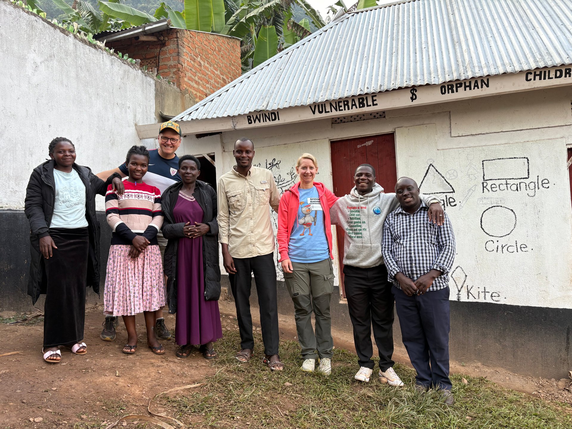
Beyond the governmental framework, several international conservation organisations operate within the Lake Victoria Basin. The African Wildlife Foundation has been involved in projects in the Bwindi region of southwestern Uganda, where our team spent time across multiple visits between 2024 and 2026. African Parks Network — known for its management of protected areas across the continent, including Akagera National Park in Rwanda on the edge of the broader Lake Victoria drainage system — represents a model of professional conservation management that some East African governments are exploring for their own protected areas. These organisations do not govern the lake directly, but they shape the broader ecosystem of conservation practice in East Africa that ultimately affects what flows into Lake Victoria from the surrounding landscape.
Lake Victoria in Context — East Africa's Broader Lake Landscape
Lake Victoria is the centrepiece, but East Africa is a region of extraordinary lacustrine diversity. Understanding the lake in isolation misses the ecological and cultural web in which it sits. Within a few hundred kilometres of Lake Victoria's shores, travellers encounter some of the most remarkable lakes on the African continent.
The Western Rift — Lakes Kivu, Albert and Edward
West of Uganda, the Albertine Rift contains a chain of deep rift lakes that are geologically and ecologically distinct from Victoria. Lake Kivu, on the border between Rwanda and the Democratic Republic of Congo, is connected to three harbour towns on the Rwandan side, served by passenger ferries that make lake transport an everyday reality for local residents. Unlike Lake Victoria, Lake Kivu is known for its dissolved methane and carbon dioxide — gases that make it both a potential energy source and an unusual ecological environment. Lake Albert, on Uganda's western border with the DRC, sits at a lower altitude and receives the outflow from Lake Edward and the Semliki Valley.
These western rift lakes are not part of the Lake Victoria Basin, but they form part of the same broad East African travel landscape. Visitors who spend time in the Bwindi region — as our team did across several visits, including eleven days in October 2024 — move through a landscape where the water table, the forest ecology, and the human communities are all shaped by the proximity of multiple lake systems, even when Lake Victoria itself is not visible.
The Crater Lakes of Western Uganda
Between Fort Portal and the Rwenzori foothills, the Ndali-Kasenda region contains over forty volcanic crater lakes scattered across a landscape of tea plantations and highland forest. These small lakes — including Kyaninga Crater Lake, six kilometres north of Fort Portal, and Lake Kifuruka — are not connected to Lake Victoria's basin, but they represent the same broader geological process: the stretching and fracturing of the East African plateau that created the rift valleys, shaped the lake basins, and gave this part of Africa its extraordinary topographic variety.
Lake Mutanda, north of Kisoro in southwestern Uganda, sits at a higher altitude and offers views of the Virunga volcanoes across the border in Rwanda and the DRC. Lake Nkuruba, managed by a community campsite operating since 1991, gives visitors direct access to a small forest-fringed crater lake with birdwatching and canoe opportunities. These smaller lakes are reached by road from Kampala via Queen Elizabeth National Park or from the town of Fort Portal — journeys that take visitors through landscapes where Lake Victoria's ecological influence fades and a different, more vertical geography takes over.
Lake Nabugabo — Victoria's Isolated Sister
Lake Nabugabo is a freshwater lake immediately south of Bukakata on Uganda's western Lake Victoria shore, separated from the main lake by only a narrow forested sandbar. This isolation — geologically recent, perhaps 4,000 years old — has produced a small set of endemic cichlid fish species found nowhere else on Earth. Lake Nabugabo is smaller and quieter than Lake Victoria but ecologically significant: it is one of the few places in East Africa where the evolutionary processes that produced the lake's extraordinary fish diversity can be studied in near-real-time.
Experiencing Lake Victoria — From the Uganda Shore
Most international visitors to Lake Victoria in Africa arrive through Uganda's Entebbe International Airport and encounter the lake within hours of landing. Entebbe sits on a peninsula that juts southward into the lake, and the relationship between the town and the water is immediate and functional: the botanical gardens at the northern tip are directly on the shore, the golf club occupies a long stretch of lakeside ground, and the beaches at Aero Beach and the various hotel waterfonts give visitors a sense of the lake's scale before they have had time to think much about it.
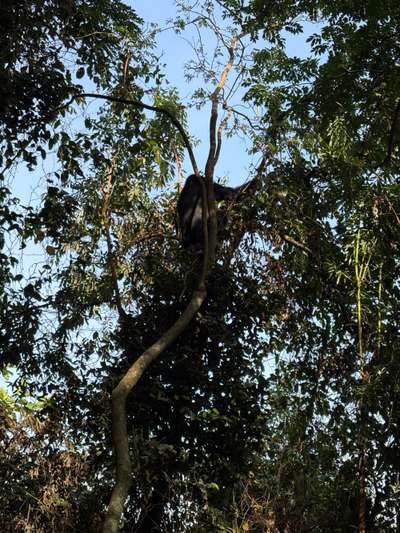
The gorilla trekking experience at Bwindi Impenetrable Forest — which draws thousands of visitors to Uganda each year and generates a significant portion of the country's conservation funding — is geographically separate from Lake Victoria but economically and logistically connected. In January 2026, after about an hour of trekking, our group encountered the first gorilla family: one of the adults was sitting high in a tree, feeding on leaves. The moment is exactly what the permit fees and the conservation infrastructure exist to protect. The connection to the lake is indirect but real: the revenue that gorilla trekking generates flows through the Uganda Wildlife Authority and a portion is distributed to communities surrounding protected areas, some of which are also fishing communities on Lake Victoria's tributaries.
For visitors whose primary interest is the lake itself, the Ssese Islands archipelago offers the most sustained encounter with Lake Victoria in Africa. The 84 islands that make up the Ssese group range from substantial and inhabited — Bugala Island has roads, towns, and regular ferry connections from Nakiwogo pier near Entebbe — to small, forested, and entirely uninhabited. The ferry crossing takes three to four hours; speedboat charters do it in about ninety minutes. June is a good month to visit: the long rains have ended, the air is clear, and the lake surface is relatively calm in the mornings.
Lake Victoria and Tourism Infrastructure
Uganda's tourism sector around Lake Victoria has been growing steadily. Yellow Haven Lodge, located at Kawuku on the lake's shore south of Kampala, offers apartments with a private pier and a restaurant called The Snug that looks directly over the water. The Protea Hotel Kampala borders the lake's northern urban fringe. The Serena Hotels group operates a five-star property on Nakasero Hill in Kampala that is the city's most prominent luxury option for visitors transiting between the lake and Uganda's other attractions.
The Uganda Tourism Board and the EAC's tourism pillar under Vision 2050 both identify Lake Victoria as a major underutilised asset. The lake's potential as a tourism destination within East Africa remains only partially realised — largely because the infrastructure for water-based tourism (piers, licensed boat operators, accommodation on the islands) has developed unevenly, and because the lake competes for visitor attention with Uganda's gorilla trekking, Kenya's Masai Mara, and Tanzania's Serengeti. What Lake Victoria offers that those destinations cannot is scale, accessibility, and a human texture — the fishing communities, the island villages, the daily working life of the water — that wildlife-focused tourism tends to obscure.