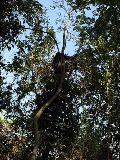
In January 2026, after an hour of walking through Bwindi Impenetrable Forest, I came across a mountain gorilla sitting in the branches of a large tree, feeding on leaves. I had been photographing the family group for some time when the light shifted and one gorilla settled into the canopy with unhurried patience, pulling leaves toward its mouth in a gesture of total ease. The GPS on my camera placed the moment at -0.9735°N, 29.6281°E — deep in the forest that sits at the edge of the Albertine Rift. That same forest ecosystem is part of the same hydrological story as the River Rwizi, twenty kilometres to the east: water from the mountains and forests feeds the rivers, the rivers sustain the wetlands, and the wetlands filter the water that eventually makes its way toward Lake Victoria and the Nile.
The Rwizi catchment is one of southwest Uganda's most important water systems. The River Rwizi drains the southwestern highlands — including parts of Mbarara, Ntungamo, Isingiro, and Rwampara Districts — before flowing northwestward toward Lake George. From there, the Kazinga Channel carries water into Lake Edward and the upper Nile system. This arc connects the wetlands of the Rwizi basin directly to the broader Lake Victoria system and to the climate dynamics that make southwest Uganda one of the most ecologically complex parts of East Africa.
Rwampara District — created in 2019 when it was carved out of Mbarara District — sits at the centre of this catchment. It is a compact district of roughly 1,200 square kilometres, characterised by rolling hills, river valleys, and a mix of agricultural land and protected forest that is actively managed under its Local Government Development Plan (LGDP IV, covering 2025 to 2030). Understanding the ecology of the Rwizi wetlands means understanding Rwampara District: its governance, its land use pressures, and its efforts to maintain wetland function in the face of agricultural expansion and a shifting climate.
The Rwizi Catchment: Geography and Ecological Significance
The River Rwizi originates in the hills east of Kabale, rising close to the border with Tanzania. It flows northwestward through Ntungamo, Mbarara, and Rwampara Districts, draining a catchment that captures rainfall from the southwestern highlands. The upper catchment receives rainfall from orographic uplift as moisture-laden air from Lake Victoria encounters the hills, producing some of the most reliable rainfall in Uganda. Annual totals in the highland portions of the catchment can reach 1,200 to 1,400 millimetres, distributed across two rainy seasons.
The ecological significance of the Rwizi catchment lies in its function as a bridge between highland forests and lowland lake systems. Forest cover in the upper catchment — including the Rwoho and Bugamba Central Forest Reserves — slows water movement through the landscape, allowing infiltration and reducing peak flood flows. Wetlands in the middle and lower catchment perform a complementary function: they store water during peak rainfall periods, filter sediments and nutrients before water enters the river channel, and release water slowly during dry periods, sustaining river flows that would otherwise fall to intermittent trickles.
The relationship between forest cover, wetland extent, and river flow is well documented in East African catchments. When forest cover is removed — whether through encroachment for agriculture, charcoal production, or settlement — hillslope erosion increases, sediment loads in rivers rise, and wetlands receive larger pulses of suspended material that gradually reduces their depth and ecological value. The Rwizi has experienced exactly this trajectory over the past three decades as population pressure on the highlands has intensified.
The Orunyere Wetland: Ecology at the District Boundary
The Orunyere Wetland lies in Rwampara District on the border with Ntungamo District. Like most wetlands in southwest Uganda, it is dominated by papyrus — the tall sedge that forms dense reedbeds across Uganda's lake margins and river floodplains. Papyrus wetlands are among the most productive ecosystems in the world by biomass, and they provide a suite of ecological services that extend far beyond their visible extent.
Water filtration is perhaps the most tangible function of the Orunyere Wetland. Agricultural runoff from the surrounding hills carries dissolved fertilisers, pesticides, and soil particles into the drainage network. As water slows in the wetland, suspended sediment settles out, and microbial communities in the papyrus root zone process nutrient loads before they reach the river channel. Studies of papyrus wetlands in Uganda and Kenya have documented nitrogen and phosphorus removal efficiencies of 70 to 90 percent under normal flow conditions. Without this natural filtration, downstream water quality — including the water that ultimately flows into Lake Victoria — would be substantially degraded.
The Orunyere Wetland is also important biodiversity habitat. Uganda has over 1,000 bird species, many of which are wetland-dependent. Papyrus stands provide nesting sites for papyrus yellow warbler, papyrus gonolek, and sitatunga antelope — a semi-aquatic antelope that is almost entirely confined to papyrus swamp habitat across East and Central Africa. Amphibians, including several species found only in the Albertine Rift region, breed in the shallow margins of wetlands like Orunyere.
The boundary position of the Orunyere Wetland — straddling Rwampara and Ntungamo Districts — creates a governance challenge that is common to many Ugandan wetlands. Each district manages its own side of the boundary, with separate district environment offices and separate enforcement resources. Coordinating wetland protection across district lines requires formal agreements and shared monitoring, which the current LGDP IV framework for Rwampara attempts to address through its Natural Resources Programme, a component that covers forests, wetlands, climate change adaptation, and water resources management.
Rwoho and Bugamba: Forest Reserves as Watershed Infrastructure
The Rwoho Central Forest Reserve covers approximately 9,100 hectares in Rwampara District. It is a medium-altitude forest lying between roughly 1,400 and 1,700 metres above sea level, on the edge of the zone where montane forest transitions into the more open grassland and farmland of the southwestern plateau. Rwoho is managed by Uganda's National Forestry Authority (NFA) as a Central Forest Reserve — a category that permits regulated timber harvesting and community use but prohibits conversion to farmland.
As watershed infrastructure, Rwoho performs an essential role in the Rwizi catchment hydrology. Tree roots penetrate deep into the laterite soils of the highland slopes, holding hillsides against erosion and maintaining the soil structure that allows rainfall to infiltrate rather than run off. The forest floor accumulates organic matter — leaf litter, decomposing wood, fungal mats — that acts as a giant sponge, absorbing and slowly releasing water throughout the dry season. Springs that feed the upper tributaries of the Rwizi emerge from forest-covered hillsides; where forest has been cleared nearby, these springs often diminish or disappear within a decade.
The Bugamba Central Forest Reserve, at approximately 1,210 hectares, is smaller but ecologically significant as a connecting patch within the broader forest landscape. Fragmented forests are a hallmark of southwest Uganda's landscape: the original montane forest that once covered the highlands has been reduced to a mosaic of protected reserves, woodlots, and isolated trees. The value of reserves like Bugamba increases the more isolated they become — they function as refuges for forest-dependent species that cannot survive in the surrounding agricultural matrix, and as sources of seeds and individuals that can recolonise degraded areas if conditions improve.
Rwampara District's LGDP IV (2025–2030) includes a dedicated Natural Resources Programme covering forest management plans for Rwoho and Bugamba Central Forest Reserves, wetland protection including the Orunyere Wetland, climate change adaptation, and water resources management. The programme is implemented in partnership with the District Environment Office and development partners including TPO (a development organisation focused on orphans and vulnerable children care).
Climate Change Pressures on the Rwizi Wetland System
Southwest Uganda sits within a climate zone that has experienced significant changes over the past four decades. Mean annual temperature in the Albertine Rift region has risen by approximately 0.5 to 1.0 degrees Celsius since the 1970s, with the rate of warming accelerating in recent years. Rainfall patterns have become more variable: the long rains season (March to May) has shown increased unreliability, with farmers reporting more frequent false starts followed by dry spells at a critical period for crop establishment. Extreme rainfall events — heavy downpours concentrated over short periods — have become more common, increasing erosion risk on exposed hillslopes.
For the Rwizi wetland system, rising temperatures create a specific problem: increased evapotranspiration. As temperatures rise, water loss from both open water surfaces and vegetation increases. Papyrus is a high-transpiration plant — a dense papyrus swamp can lose as much water to the atmosphere through its leaves as an open water surface of the same area loses through evaporation. In a warmer climate, wetlands that are not receiving adequate rainfall input will shrink at their margins, with papyrus retreating from areas that no longer sustain sufficient soil moisture for its root system.
Agricultural encroachment adds to this pressure. The population of southwest Uganda has grown significantly in recent decades, driven partly by high birth rates and partly by migration from other districts. As demand for agricultural land increases, the edges of wetlands are often the first areas targeted. They have fertile, moisture-retentive soils and are often not formally titled, making encroachment difficult to contest legally. The result, documented across multiple wetland sites in Uganda, is a gradual compression of wetland area from the margins inward — a process that is difficult to reverse once it has progressed beyond a threshold.
The Rwampara District Environment Office, working within the LGDP IV framework, is responsible for monitoring and enforcing wetland boundaries, conducting environmental impact assessments for development activities near wetlands, and implementing climate change adaptation measures identified in the district plan. These include community awareness programmes, tree planting on degraded hillslopes adjacent to forest reserves, and the installation of small-scale erosion control structures in sub-catchments where gully erosion threatens river water quality.
Mountain Gorillas and the Wetland Connection
Bwindi Impenetrable National Park, which protects approximately half of the world's remaining mountain gorilla population, lies at the western edge of the zone that drains toward the Rwizi catchment. When I photographed gorillas at Bwindi in January 2026, the forest I was standing in was part of the same hydrological landscape as the Rwizi wetlands — a landscape where forest integrity in the uplands directly supports water quality and quantity in the valley bottoms.
Mountain gorillas depend on intact forest for food, shelter, and movement between family ranges. Bwindi and the adjacent Sarambwe Forest Reserve in the DRC together support the highest density of mountain gorillas anywhere in the world. Their presence in this landscape is itself an indicator of ecological health: mountain gorillas require large patches of undisturbed forest with a diverse understorey, and their continued survival depends on the absence of significant forest fragmentation between key habitat areas.
The connection between gorilla conservation and wetland ecology is not direct — gorillas do not use wetland habitats — but it is real at a landscape scale. Intact forest cover in the Bwindi-Rwenzori arc reduces erosion, maintains springs that feed rivers including the Rwizi tributaries, and sustains the local rainfall cycle through transpiration. Communities near Bwindi who benefit from mountain gorilla tourism revenue have an economic incentive to support forest protection — and by extension, the watershed function that the forests provide to the valley wetlands downstream.
Visiting the Rwampara Region: What to Expect
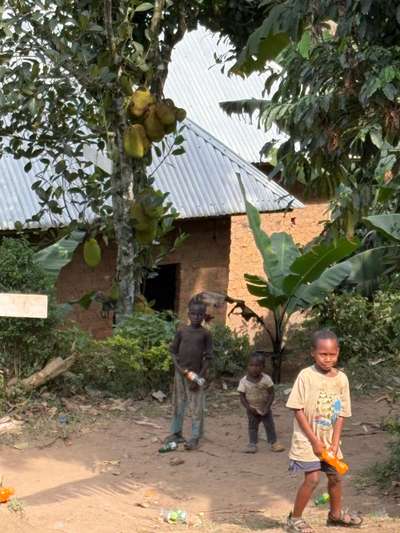
Rwampara District is not on the standard tourist circuit in Uganda, but it lies along the route that many visitors take from Kampala to Bwindi Impenetrable National Park for mountain gorilla trekking. The main road passes through Mbarara, skirts the edge of Rwampara District, and continues toward Kabale and eventually Buhoma or Nkuringo — the two main entry points for Bwindi. Travellers making this journey pass through the upper Rwizi catchment without necessarily knowing it, crossing rivers and viewing wetlands that form part of the ecological system described in this article.
The Nyore Hillside Retreat in Kinoni Town Council, Rwampara District, offers accommodation for visitors who want to slow down and engage with the landscape beyond the gorilla circuit. The Rwoho Central Forest Reserve is accessible from the area and offers forest walks with birdwatching. With over 350 bird species recorded in Rwoho and the surrounding landscape, it is a serious birding destination — less visited than Bwindi but rewarding for those who take the time to explore it.
The best season for visiting the Rwizi wetlands is outside the peak rainy seasons — June to August and December to February offer the driest conditions and most reliable road access. The short rains in October and November can make rural roads impassable in some areas. Wetland margins are most accessible in the dry season, when water levels are lower and vegetation is less dense. Bird activity peaks in the early morning hours throughout the year.
[QUOTE: local guide on first impressions of the Orunyere Wetland and its changes over the past decade]