Uganda · Environment
Uganda's Disappearing Wetlands
7,500 km² lost in two decades — what it means for water, food, and the people who depend on both
Photo: Mark Suer, Buhoma, Uganda, June 2026
7,500 km² lost in two decades — what it means for water, food, and the people who depend on both
Photo: Mark Suer, Buhoma, Uganda, June 2026
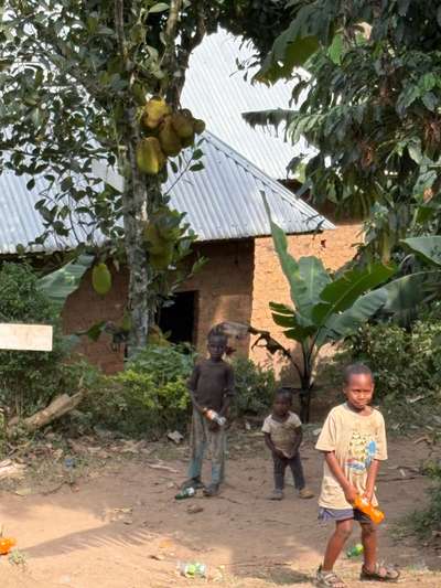
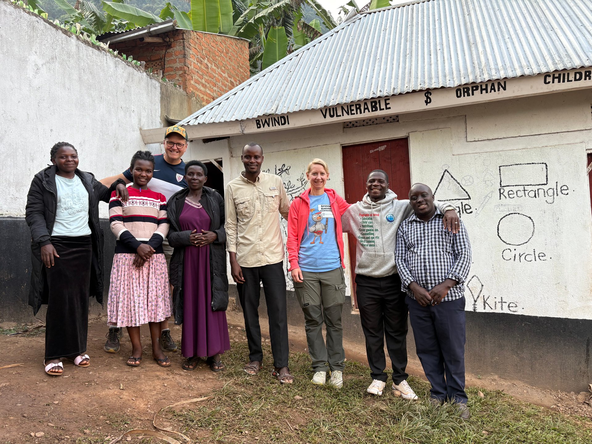
On the morning of June 21, 2026, we were sitting with a small group of children outside a simple clay building in Buhoma, near the edge of Bwindi Impenetrable Forest. Three of them had wandered over from the orphanage next door — thin, a little hesitant, their clothes worn. We invited them to eat with us. The moment was unremarkable in the way that the most important things often are. But it stayed with me, because it illustrated something that no statistic quite captures: the distance between a number on a page and a life shaped by it.
Buhoma sits in one of Uganda's most ecologically intact corners. The forest around it is still dense, the hillsides still green. But across the country, the systems that hold water, filter nutrients, and buffer floods have been disappearing at a pace that the National Status of the Environment Report 2024 (NSOER 2024) now quantifies with uncomfortable precision: Uganda lost 7,500 square kilometres of wetlands between 2000 and 2021. That is an area larger than the entire country of Brunei, drained, cultivated, or built on in little more than two decades. An estimated 5,000 hectares continue to disappear every year, according to the same report (citing UBOS, 2024).
Wetlands are not simply scenic landscapes. They are the kidneys of a watershed — absorbing peak flows, filtering agricultural runoff, recharging groundwater, and sustaining the fish nurseries that feed millions of people. When they go, the effects are felt downstream: in flooded communities along the Victoria Nile, in degraded water quality entering Lake Victoria, and in the increased soil erosion that strips productivity from already fragile hillsides. Understanding Uganda's wetland crisis is inseparable from understanding the lake itself.
According to NSOER 2024: Uganda's wetland cover fell from 15.6% of land area in 1994 to 13% by 2017 and 13.9% in 2021 — with only 8.9% remaining relatively undisturbed. Wetland degradation is especially pronounced in the eastern region, where biodiversity loss, poor water quality, and increased flooding are already measurable.
NSOER 2024 identifies four compounding drivers: increasing human population, agricultural expansion, urbanisation, and infrastructure development. Each is real and well-documented, but the picture on the ground is more textured than any single factor suggests.
Agriculture is the dominant pressure. Uganda's population has nearly doubled since 2000, and demand for cultivable land has pushed farming further and further into wetland margins. Rice paddy cultivation — which requires waterlogged soil — is particularly damaging in the eastern region, where extensive wetland drainage has created rice-growing areas at the direct cost of flood-buffering capacity. Sugarcane cultivation around the shores of Lake Victoria has had a comparable effect, converting papyrus swamps and sedge marshes into monoculture plantations. Conversion is often fast and largely irreversible: once drained and cultivated, a former wetland rarely recovers its original hydrology on any practical timescale.
Brick-making is a less visible but significant driver in many districts. Wetland soils — rich, dense clay — are ideal for brick production, and small-scale kilns operated from wetland margins are common in peri-urban areas across the country. The practice not only removes the physical soil structure but disrupts drainage patterns across wider areas than the extraction zone alone.
In the cattle belt of western Uganda, a different process is at work. Savannah grasslands that once provided dry-season grazing have been progressively encroached upon, and in some areas the transition from grass to bare, compacted soil has reduced infiltration rates and increased the surface runoff that accelerates erosion downstream. The charcoal trade compounds this: deforestation for charcoal production, particularly around Kampala and in the Albertine Rift, removes both the forest canopy and the root systems that hold hillside soils in place.
The highlands of Kabale and Kisoro — the most densely populated rural areas in Uganda — represent the most acute concentration of land degradation anywhere in the country. Between 85% and 90% of land in these districts is classified as severely degraded, according to NSOER 2024. The steep volcanic hillsides of the Kigezi region have been cultivated far beyond their natural carrying capacity, and the soil erosion that results carries silt directly into Lake Bunyonyi and into the headwaters of the Kagera River system that feeds Lake Victoria. What happens on a hillside in Kisoro does not stay there.
Wetland loss does not simply remove habitat — it removes the filtering layer between the land and the lake. The consequences travel downstream and accumulate in water bodies that millions of people depend on.
When wetlands that normally intercept agricultural runoff are removed, organic phosphates and nitrates flow directly into rivers and lakes. Eutrophication — the over-enrichment of water bodies with nutrients — depletes dissolved oxygen, kills fish, and produces toxic algal blooms. Lake Victoria's western and northern bays have shown measurable eutrophication trends linked to intensifying agricultural activity in upstream catchments. NSOER 2024 describes pollution from industrial discharges, agricultural runoff, and domestic waste as actively degrading water quality and harming aquatic life across the drainage basins of Lake Victoria, Lake Kyoga, and the Albert Nile.
Water hyacinth (Eichhornia crassipes), first recorded in Lake Victoria in the 1980s, thrives in eutrophic conditions — the same nutrient enrichment caused by wetland loss and agricultural runoff. Dense mats block boat traffic, destroy fishing grounds, reduce oxygen levels, and create habitat for disease vectors including bilharzia-carrying snails. Control campaigns have had temporary success, but the underlying nutrient loading that fuels regrowth remains largely unchanged as long as wetland filtration capacity continues to decline.
Intact wetlands slow peak flood flows, allowing water to infiltrate gradually and releasing it over weeks rather than hours. When those wetlands are drained, rainfall events that a healthy catchment would have absorbed instead run off rapidly, producing the flash floods that have displaced thousands of households along the Victoria Nile in recent years. Communities in Kiryandongo District and along the Kafu River corridor have directly experienced this dynamic. The wetlands were not simply wildlife habitat — they were functional flood infrastructure.
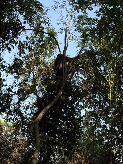
Rwampara District in western Uganda, created in 2020 by subdivision from Mbarara District, illustrates both the pressures on wetlands and the institutional frameworks being built to address them. The district is currently preparing its Local Government Development Plan IV (LGDP IV) for 2025–2030, a process that explicitly includes natural resource management alongside health, education, and economic development.
Within Rwampara's borders lies the Orunyere Wetland, a seasonally inundated depression bordering Ntungamo District that provides important habitat for waterbirds, frogs, and the papyrus-dependent species characteristic of Uganda's lowland wetlands. Like many such wetlands in the region, Orunyere faces pressure from drainage for agriculture and encroachment at its margins, where soils are most fertile.
The district also contains two significant forest reserves managed by the National Forestry Authority. Rwoho Central Forest Reserve covers 9,100 hectares and supports a montane forest ecosystem that captures rainfall and releases it slowly into the River Rwizi catchment. Bugamba Central Forest Reserve (1,210 hectares) provides a smaller but ecologically connected fragment of forest cover. Both are included in the district's Forest Management Plans — a formal commitment to protecting, restoring, and adding value to forests and wetlands in the area.
The Natural Resources Programme operating in Rwampara has a mandate for climate change response, water resource management, and wetland protection. Development partners including TPO (Transcultural Psychosocial Organization) support community welfare services in the district, and the Uganda Health Activity provides family health services as a designated partner under LGDP IV. Mountain gorillas in the adjacent Bwindi Impenetrable and Mgahinga National Parks are identified in the development plan as a major tourism product — one that depends directly on the intact forest-wetland system the district is working to maintain.
[QUOTE: local forestry officer on the biggest pressure facing Rwoho Central Forest Reserve]
Bigodi Wetland Sanctuary — adjacent to Kibale National Park in western Uganda. A community-managed boardwalk through papyrus and forest-edge habitat. Home to over 200 bird species including the Great Blue Turaco. One of Uganda's most rewarding birding experiences, easily combined with chimpanzee tracking in Kibale.
Mabamba Swamp — on the northwestern shore of Lake Victoria, 45 minutes from Entebbe. The most reliable location in Uganda to see the shoebill stork. Boat trips depart from Mabamba village and typically last two to three hours in the early morning.
Orunyere Wetland, Rwampara District — less visited than the above, representative of the wetland types most affected by agricultural encroachment in Uganda's southwestern highlands.
Uganda's legal framework for wetland and environmental protection was strengthened significantly in 2020. The National Environment (Audit) Regulations, Statutory Instrument No. 47 of 2020 establish requirements for environmental audits of activities that affect ecosystems, including wetland drainage and conversion. The National Environment (Waste Management) Regulations, Statutory Instrument No. 49 of 2020 set standards for waste disposal that bear directly on the industrial and domestic pollution that drives eutrophication in wetland and lake systems.
On paper, these instruments are sound. The challenge has consistently been enforcement. Uganda's National Environment Management Authority (NEMA) operates with limited field personnel relative to the geographic scale of its mandate, and local government enforcement of wetland protection orders has been inconsistent. The districts under the most economic pressure — where wetland conversion generates the most immediate benefit for individual farmers or investors — are often those with the weakest enforcement capacity.
NSOER 2024 documents a gap between stated policy goals — Uganda officially committed to zero net loss of wetland area — and the measured reality of continuing decline. Closing that gap requires not only stronger enforcement but also economic alternatives for communities currently dependent on wetland cultivation, and sustained investment in the monitoring systems needed to detect degradation before it becomes irreversible.
The drainage basins of Lake Victoria, Lake Kyoga, and the Albert Nile are explicitly identified in NSOER 2024 as crucial for Uganda's water balance. Wetlands within these basins perform flood control, water filtration, and groundwater recharge functions that no engineering substitute can replicate at comparable cost. Their continued loss is not an abstract environmental concern — it is a direct threat to the water security and food security of the people living downstream.
According to the National Status of the Environment Report 2024, Uganda lost 7,500 square kilometres of wetlands between 2000 and 2021. An estimated 5,000 hectares are lost every year. Wetland cover fell from 15.6% of land area in 1994 to 13.9% in 2021, with only 8.9% of that remaining area in a relatively undisturbed state.
The main drivers are agricultural expansion (particularly rice and sugarcane cultivation), population growth, urbanisation, and infrastructure development. Brick-making from wetland clay soils is a significant localised driver in peri-urban areas. Industrial and domestic pollution degrades remaining wetlands through eutrophication even where physical drainage has not occurred.
Wetland loss increases the severity and frequency of flooding by removing the buffering capacity of wetlands in the Lake Victoria, Lake Kyoga, and Albert Nile drainage basins. It reduces water filtration, accelerating the eutrophication of lakes and rivers. It drives biodiversity loss, removes fish nursery habitat, and degrades the water quality on which millions of Ugandans depend for drinking, fishing, and irrigation. Soil erosion — affecting 85% of Uganda's degraded land area — is significantly worsened where wetland and forest cover has been removed.
Key wetlands include Bigodi Wetland Sanctuary in western Uganda (a community-managed birding site adjacent to Kibale National Park), Mabamba Swamp on the northwestern shore of Lake Victoria (the most reliable location to see the shoebill stork), and the Orunyere Wetland in Rwampara District. The papyrus swamps along Lake Victoria's shores and in the Kagera delta are also ecologically critical, providing habitat for the Sitatunga antelope and dozens of papyrus-specialist bird species.
The National Environment (Audit) Regulations S.I. No. 47 of 2020 and the National Environment (Waste Management) Regulations S.I. No. 49 of 2020 are the primary current instruments. Uganda's broader environmental governance is overseen by the National Environment Management Authority (NEMA). Enforcement remains inconsistent, and the gap between legal protection and actual wetland condition is documented in NSOER 2024.